|
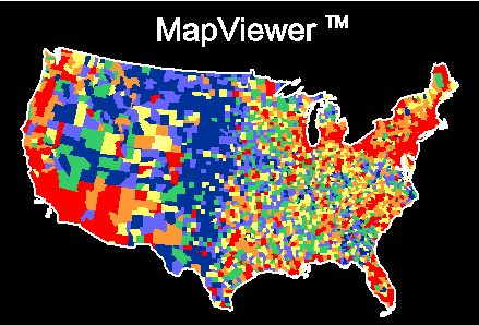
Map Types
MapViewer provides you with several map types to present your
data in the most informative way possible. You can combine any number of map types
in a single window to present several types of data in a single map. The MapViewer map
types include:
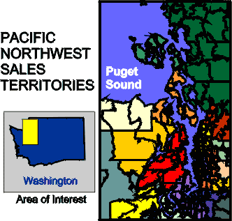
- Base Maps show geographic information and can use
different line styles, fill patterns and colors to effectively present boundary
information.
- Prism Maps represent data as three-dimensional raised
areas proportional to data values assigned to the areas.
- Hatch Maps display data ranges with different colors
and patterns.
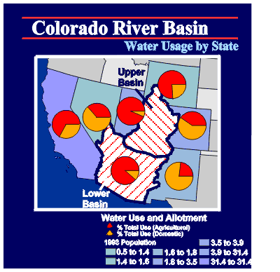
- Pie Maps display several data variables as pie charts
for each area or point on the map.
- Symbol Maps place proportionally scaled symbols at
each area or point.
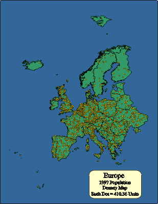
- Dot Density Maps show distribution of data as dots
where the number of dots in an area is proportional to the data value assigned to that
area.
- Bar Maps show several data values as bar charts for
each area or point on the map.
- Post Maps display text or data values read from the
worksheet.
- Pin Maps show point locations on a map.
MapViewer Boundary and Data Files
The following is a list of boundary and data files included
with MapViewer. These files are suitable for creating a wide variety of maps. You
can also create custom boundaries by combining existing boundaries or by using the drawing
tools. MapViewer can import boundary files in several different formats so you can
also use files created in other applications.
The MapViewer CD-ROM contains Golden Software’s entire
library of data files and boundary files.
City
- Akcity.bna - Wycity.bna: point locations of
cities in latitude/longitude coordinates
DLG
- The DLG directory contains USGS 1:2,000,000 scale DLG files
converted to Golden Software Boundary (GSB) file formats.
US County
- Ak.gsb-Wy.gsb: county boundary files, Primary
IDs are FIPS codes
- Ak.dat-Wy.dat: 1990 US Census data for each
county
- Counties.gsb: map of all US counties
- Counties.dat: 1990 US Census data for all US
counties
US County High Resolution
- Ak_hires.gsb-Wy_hires.gsb: high-resolution
county boundaries
US Miscellany
- ADI.gsb: Areas of Dominant Influence boundaries
- DMA.gsb: Demographic Marketing Areas boundaries
- MSA.gsb: Metropolitan Statistical Areas
boundaries
- US50ll.gsb: United States map in Unprojected
latitude/longitude
- US50alb.gsb: United States map in Albers
projection
- US50.dat: 1990 Census data for each state
- UScity.gsb: point location of select US cities
- USintll.gsb: major US interstate highways
World
- Africa.gsb: African countries
- Antarcal.gsb: Antarctica Albers projection
- Antarcll.gsb: Antarctica Unprojected
Latitude/Longitude
- Asia.gsb: Asian countries
- Camerica.gsb: Central American countries
- Canada.gsb: Canadian provinces
- Europe.gsb: European countries
- Mexico.gsb: Mexico states
- Namerica.gsb: North American countries
- Oceania.gsb: Australia, New Zealand, and
neighboring island nations
- Russia.gsb: Russia boundary
- Samerica.gsb: South American countries
- World.gsb: countries in the world
- World.dat: 1990 data for countries
- Worldcap.gsb: point locations of country
capitals
Zip3
- Akzip3.gsb-Wyzip3.gsb: three digit zip code sectional
centers for the United States
Zip5
- Akzip5.bna-Wyzip5.bna: five digit zip code boundaries
for the United States
Importing Boundaries from Other
Applications
MapViewer can import boundary information in several
different vector and bitmap formats. These include:
- Golden Software GSM, GSB, BLN, PLT
- Atlas BNA
- USGS DLG
- AutoCAD DXF
- Windows Metafile WMF
- Windows Clipboard CLP
- Bitmap formats include TIF, BMP,TGA, PCX, GIF, DCX, JPG, PCT,
WPG
- Also, you can read coordinates from worksheet data files to
place point locations on the map. Data files containing any type of coordinates can be
used to indicate points.
Worksheet
MapViewer creates thematic maps by linking worksheet data to
areas or points on the map. If you need to display your own data on a map, MapViewer
includes a full-featured worksheet that allows you to display, enter, edit and save your
data. You can read data files in many formats, including XLS, SLK, WKx, CSV, TXT, DAT,
MDB, DBF, DB, and BNA. In the worksheet you can transform, sort, and calculate statistics
on your data. The number of data points the worksheet can handle is only limited by the
amount of memory you have available on your computer.
Additional Features
There are many additional features that MapViewer provides,
including:
- Annotate your maps with text using any typeface, size or color
- Place text at any position on the map, and display it at any
angle
- Display place names, data information, or any type of text on
your maps
- Enhance maps by drawing objects at any position
- Create circles, squares, rectangles, polylines, polygons, or
point symbols at any location on the map
- Create multi-layered maps to present more information
- Zoom in on areas to show different levels of detail
- Explode, rotate or scale selected areas
- Create custom colors
- Create maps using any coordinate system
- Convert between Unprojected Latitude/Longitude, Albers Equal
Area, or Miller Cylindrical projections
- Recalibrate maps to use any coordinate system
- Convert areas to curves and curves to areas
- Thin boundaries to reduce file size when detail is not
required
- Display multiple views of the same map, all at different zoom
levels
- View the data and the map simultaneously
- Move or Copy map features between map layers
- Turn on or off the display of any map or page features
- Many more!
Year 2000 compliance
All Golden Software products are year
2000 compliant.
Golden Software represents and warrants that Surfer, Grapher,
MapViewer and Didger are designed to be used prior to, during, and after the calendar year
2000 AD. Surfer, Grapher, MapViewer and Didger will operate during each such time period
without error relating to date data, specifically including any error relating to, or the
product of, date data which represents or references different centuries or more than one
century.
System Requirements
- Operating System: Windows 95/98, NT 4.0
- 20 MB of free hard disk space
- 800 X 600 minimum monitor resolution
Learn more about Golden
Software Products on this CD!
Home * Surfer
* Grapher * MapViewer
* Didger
Please visit the Golden Software web site
at
http://www.goldensoftware.com!
While visiting the web site, you'll be
able to
buy MapViewer
or download a demo copy!
Copyright 1997 - 2000, Golden Software, Inc. |