MapViewerTM 3 is Now Shipping!
What’s New with MapViewer 3?
New Full 32-bit Program
MapViewer 3 runs on Windows 95/98 and Windows NT 4.0 operating systems. The 32-bit version increases the speed of mapping operations, provides better stability and supports long file names.
New On-Screen Map Scaling
Use the Map|Scale command to rescale a map that is displayed on the screen in both the x and y directions.
New Map Type-Pin Maps
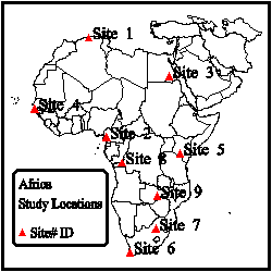
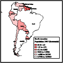
The new Pin map displays point locations on a map, replacing the Points from Worksheet command in MapViewer 2. Pin map locations can be based upon XY coordinates (such as latitude/longitude), on five digit zip code centroids or custom database files.
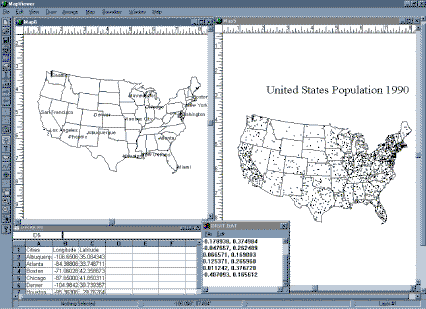
Display xy locations with MapViewer’s Pin map
New Option to Specify Default Settings
The addition of File|Preferences command allows control of the default settings with the use of set files. Mapping default settings are based on information read from the set files. It is possible to specify the default settings for line styles, fills, symbols, text and MapViewer window features.
New 5 Digit Zip Code Boundary Files
MapViewer 3 includes five digit zip code boundaries for the United States. Also included are the three digit sectional centers for the United States, world country boundaries, US State and county boundary files, and miscellaneous US boundary files including ADI, DMA, MSA and Major US Highways.
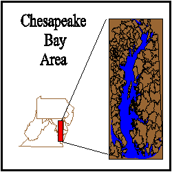
Use the 5 digit zip code boundaries to identify areas
New Auto Trace Function
Create custom boundaries by automatically tracing around the outside of a selected group of areas using the Auto Trace command.
New Import and Export Options
Many new import and export file filters have been added.
Import Options: .GSB, .DXF, .LGS, .STD, .BLN, .CLP, .PLT, .TIF, .PCX, .WPG, .JPG, .DCX, .TGA, .BNA, .LGO, .OPT, .DLG, .BND, .WMF, .GSM, .BMP, .GIF and .PCT.
Export Options: .GSB, .DXF, .CLP, .BMP, .PCX, .WPG, .PCT, .WMF, .BNA, .CGM, .TIF, .TGA, .GIF, .JPG and .DCX.
New Full Featured Worksheet
- Print the worksheet contents.
- The worksheet is now double precision. Up to 15 digits can be used without loss of precision.
- An entire suite of statistics functions has been added.
- Control cell height, width and background color.
- Save worksheet contents in the following file formats: .XLS, .SLK, .CSV, .TXT, .DAT, .BNA and .BLN.
- Open the following file formats in the worksheet: XLS, .SLK, .WK1, .WK3, .WK4, .WKS, .WRK, .WR1, .CSV, .TXT, .DAT, .BNA, .BLN, .DBF, .MDB and .DB.
New On-Screen Digitize Command
- Digitize points from a map.
- Save the point coordinates in an ASCII data file.
- Digitize projected maps and save in unprojected latitude/longitude coordinates.
Obtain point coordinates using the digitize commands.
New Color Gradations in Hatch Maps
Select the minimum and maximum range colors, and the intermediate ranges are automatically assigned with gradations between the two extremes.
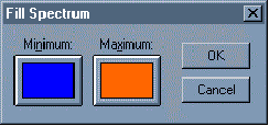
In the Fill Spectrum dialog box, minimum and maximum colors are selected.
MapViewer will automatically create color gradations for the intermediate ranges.
New Additional Features
- View data for a selected area, curve or point.
- Create Primary ID’s from text or numbers.
- Select one or more boundary objects based on their primary ID’s using the Edit|Select from List command.
- View the page position and page layout in the Map window.
- Easily add scale bars using the Map|Scale Bar command.
- New on-screen map projection conversion.
- Graticule labels.
- More levels of Undo and Redo.
- Add scale bars to maps.
- Use SQL with Pin maps.
- And many more!!!
Learn more about Golden
Software Products on this CD!
Home * Surfer
* Grapher * MapViewer
* Didger
Please visit the Golden Software web site
at
http://www.goldensoftware.com!
While visiting the web site, you'll be
able to
buy MapViewer
or download a demo copy!
Copyright 1997 - 2000, Golden Software, Inc.