What's New in Didger 2?
What major new features are included in Didger 2?
We have compiled a list of the major new features in Didger 2. This list is only a small sampling of the new features added to Didger 2.
On-Screen Digizing
This is the most significant upgrade to Didger 2. Many of our Didger 1 users requested the ability to digitize points, polylines, and polygons on top of a bitmap image. Didger 2 now supports this by providing the functionality necessary to import a bitmap or scan an image directly from any supported TWAIN compatible device. Once the image has been imported, use one of the new geo-reference methods to calibrate the image from the image coordinate space to the user defined world coordinate system. This method is nearly indentical to Didger 1.0’s tablet digitizing feature.
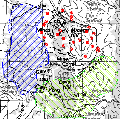
Extract regions and points from a scanned topo map.
Map Projections
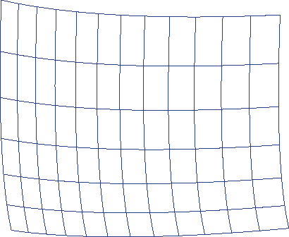
Map projections are now supported in Didger 2! This amazing new feature allows the user to specify map projection parameters when specifying your bitmap or tablet calibration. Not only is this feature available during calibration, but Didger now supports converting vector data from one map projection coordinate system to another. Using the new vector file import routines, files can be converted to and from UTM coordinates to Lat/Long with a few simple mouse clicks. Map projections and coordinate systems supported include Universal Transverse Mercator, Albers Equal Area, Orthographic, Stereographic, State Plane, and many more.
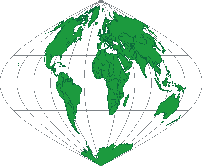
Map of the world using the Sinusoidal projection.
Import Vector Files
At the request of our loyal users, we have added importing vector files. Didger supports all of the Golden Software supported file formats including SHP, MIF, E00, BLN, BNA, and DXF to only name a few. This is a great feature, especially when combined with one of the new advanced coordinate conversion and editing functions.
Import STDS DDF files, with associated map projection parameters.
Geo-referencing
New geo-reference methods include an enhanced Affine transformation algorithm. This was the base algorithm used in Didger 1 for tablet calibration. Didger 2 also include 1st, 2nd, and 3rd order polynomial functions. Not only can the methods be used for calibration, but Didger 2 now has the ability to convert the imported vector files from one coordinate system to another using these methods. This is an incredible feature, well worth the upgrade price.
(Geo-reference method showing an Affine transformation.)
(Geo-reference method showing a 2nd order polynomial transformation)
Advanced Editing Functions
Didger 1 users requested an easier way to create polygons from polyline segments. We have responded by adding a new tool for creating polygons by a polygon marker. After digitizing your linked and snapped polyline segments, simply create polygon marker objects in the center of the newly digitized polyline segments. Once the polygon marker has been digitized, one click of the mouse will automatically begin the process of creating the polygons from the polyline segments.
Other new features include creating line intersections, snapping undershoot polylines, trimming overshoot polylines, and creating complex polygons.
Didger also includes new methods for smoothing and thinning polyline and polygon segments. One method includes applying a spline fit to the object and having the ability to specify the tension factor and the number of new vertices to create.
Another highly requested feature is the ability to resample polyline objects at specific intervals. This is a particular editing function geared toward the well log digitizer. Once the line object has been digitized, you can specify the beginning and ending value, as well as the sample interval to create the new resampled line.
Layer Manager
Managing data within Didger has never been easier. Didger now has the ability to create layers to manage the visibility and editing capability of objects on different layers.
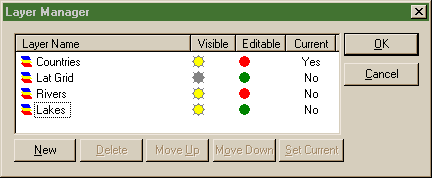
Layer manager dialog box.
Printing Capability
Didger now supports full map printing functionality. You can print your map at the scale digitized to verify the accuracy of the newly digitized data. You can also create stunning looking maps in Didger to put into reports and documents.
Beta Tester’s Comments
"This may end up being your best product because of its ability to use scanned images and then scale them for printing."
"I really like the design philosophy used to create polygons from polyline segments."
"Your mixed mode digitizing is very intuitive and will be well liked by my students. The change projection feature will be a very useful addition to my exercises that deal with the fundamentals of projections. I am particularly happy to see the vast improvement in error detection and correction from Didger 1. It turned out that the biggest problem I have had with Didger 1 was the very tedious methods by which one was forced to find small and difficult to detect errors, especially when building polygons from polylines. It is nice to see the tolerance circles and your new set of tools including, trimming of overshoots, extension of undershoots and creation of nodes at intersections are very useful. Imports went smoothly. TIF is sometimes difficult due to different "flavors" but this import (from an Multispec exported .TIF file) worked well. I adjusted the contrast and brightness. Next, I registered the image by using six features (road intersections) that had been located by GPS. The registrations went smoothly and your available options in the various dialog boxes allowed for great control. I have used layers in other programs like Mapviewer and AutoCAD. This is extremely useful and your layer management dialog box works like most others so is not hard to pick up."
"Nice job, one of the most trouble free beta-version software packages I have ever tested! Also very substantial new features over Didger 1. I am impressed!"
"Good stuff here! I'm very impressed with the capabilities of this release of Didger. I think that with the great depth of functionality of Didger 2, a large number of new users will find good stuff that that they can put to good use."
"I am very impressed with the design and functionality of this product and I know that I’m going to find it very valuable in my work. I would also like to commend you on the high standard of the documentation. Any procedural question that I had was clearly explained."
Learn more about Golden Software Products on this CD!
Home * Surfer * Grapher * MapViewer * Didger
Please visit the Golden Software web site at
http://www.goldensoftware.com!While visiting the web site, you'll be able to
buy Didger or download a demo copy!
Copyright 1997 - 2000, Golden Software, Inc.