9th
International Conference on Precision Agriculture —
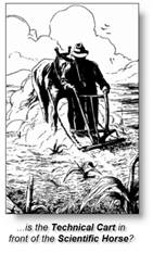
So Where Is Precision Ag?
…a brief history, current
expression and possible future directions
Keynote address by Joseph K. Berry
W. M. Keck Visiting Scholar in
Geosciences, Department of Geography,
Principal, Berry & Associates //
Spatial Information Systems
Email jberry@innovativegis.com — Web www.innovativegis.com/basis/
<click here> for
printer-friendly copy of this page
<click
here> to access support materials including PowerPoint and related paper
 Now
that precision agriculture is in its second decade, where are we? Yield mapping is gaining commonplace status
for many crops and locales.
Site-specific management of field fertilization has a growing number of
users. Remote sensing applications are
maturing. Irrigation control, field
leveling, variable rate seeding, disease/pest modeling, stress maps and a
myriad other computer mapping uses are edging over the horizon. However, it is important to keep in mind that
site-specific farming isn’t just a bunch
of pretty maps, but a set of new technologies and procedures linking mapped
variables to appropriate management actions. These revolutionary approaches are ushering
in such radical changes as a shift in agriculture research from a historical
emphasis on traditional experimental fields to "on-farm"
research/studies; a possibility of "as applied" mapping for sensitive
field inputs; a movement from traditional multivariate statistics to knowledge
engines that assess patterns and relationships within and among map layers; and
even a latent challenge of the 400 year-old Cartesian coordinate system for
geographic referencing that utilizes hexagons and polyhedrals for detailed
modeling of agricultural flows and cycles.
This presentation investigates the
legacy of Precision Ag’s unique expression of Geotechnology, its current
challenges and probable future directions.
Now
that precision agriculture is in its second decade, where are we? Yield mapping is gaining commonplace status
for many crops and locales.
Site-specific management of field fertilization has a growing number of
users. Remote sensing applications are
maturing. Irrigation control, field
leveling, variable rate seeding, disease/pest modeling, stress maps and a
myriad other computer mapping uses are edging over the horizon. However, it is important to keep in mind that
site-specific farming isn’t just a bunch
of pretty maps, but a set of new technologies and procedures linking mapped
variables to appropriate management actions. These revolutionary approaches are ushering
in such radical changes as a shift in agriculture research from a historical
emphasis on traditional experimental fields to "on-farm"
research/studies; a possibility of "as applied" mapping for sensitive
field inputs; a movement from traditional multivariate statistics to knowledge
engines that assess patterns and relationships within and among map layers; and
even a latent challenge of the 400 year-old Cartesian coordinate system for
geographic referencing that utilizes hexagons and polyhedrals for detailed
modeling of agricultural flows and cycles.
This presentation investigates the
legacy of Precision Ag’s unique expression of Geotechnology, its current
challenges and probable future directions.
Online References (contact the presenter for URL to download
the PowerPoint slide set used in the presentation)
-
Beyond Mapping III, online compilation of Beyond Mapping columns appearing in GeoWorld magazine 1996 to present with many addressing
Precision Ag topics. http://www.innovativegis.com/basis/MapAnalysis/Default.htm
-
Map Analysis textbook
published by GeoTec Media; J.K. Berry, 2007; provides a structured view of
grid-based map analysis with software, database and “hands-on” exercises. http://www.innovativegis.com/basis/Books/MapAnalysis/Default.htm
-
Applying
Spatial Analysis for Precision Conservation across the Landscape, J. of Soil and Water Conservation, Nov/Dec 2005, Vol.
60, No. 6, pg 22-29. J.K. Berry, J. A.
Delgado,
-
Precision Conservation
for Environmental Sustainability, J.
of Soil and Water Conservation, Nov/Dec 2003, Vol. 58, No. 6, pg 332-339. J.K. Berry, J. A. Delgado,
-
Quantitative Methods for Analyzing Map Similarity and
Zoning, GeoTech Conference,
Toronto, Ontario, Canada, April 8-11, 2002. J.K. Berry. http://www.innovativegis.com/basis/present/GIS02_similarity/GIS02_similarity.htm
-
Who’s
Minding the Farm, GeoWorld, Adams Business Media,
- Site-Specific Farming Comes of Age, FarmTech '98 Conference, Ricon Publishing, January, 1998, J.K. Berry. http://www.innovativegis.com/basis/present/Fieldvariation.htm
 Joseph K.
Berry is a leading consultant and educator in the
application of Geographic Information Systems (
Joseph K.
Berry is a leading consultant and educator in the
application of Geographic Information Systems (